
Thank you for supporting this site ❤️
Make a donation
Make a donation
Gear up for your next adventure:
As an Amazon Associate, this site earns from qualifying purchases at no extra cost to you.
Puy-de-Dôme topographic map
Click on the map to display elevation.
Thank you for supporting this site ❤️
Make a donation
Make a donation
Gear up for your next adventure:
As an Amazon Associate, this site earns from qualifying purchases at no extra cost to you.
About this map
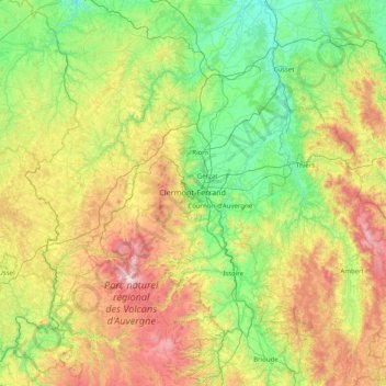
Name: Puy-de-Dôme topographic map, elevation, terrain.
Location: Puy-de-Dôme, Auvergne-Rhône-Alpes, Metropolitan France, France (45.28705 2.38802 46.25629 3.98563)
Average elevation: 2,162 ft
Minimum elevation: 686 ft
Maximum elevation: 6,070 ft
Thank you for supporting this site ❤️
Make a donation
Make a donation
Gear up for your next adventure:
As an Amazon Associate, this site earns from qualifying purchases at no extra cost to you.