Geolocate

Kottathara topographic map

Click on the map to display elevation.

About this map

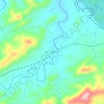
Name: Kottathara topographic map, elevation, terrain.

Location: Kottathara, Mannarkad, Palakkad, Kerala, India (11.11288 76.66561 11.15288 76.70561)

Average elevation: 1,801 ft

Minimum elevation: 1,565 ft

Maximum elevation: 2,572 ft

Other topographic maps

Click on a map to view its topography, its elevation and its terrain.

Thachanattukara

India > Kerala > Mannarkad > Thachanatukkara

Average elevation: 233 ft

Gear up for your next adventure:

🏕️Tent Footprint - Protect your tent base from wear
🪶Trail Camera - Capture wildlife on your hikes
🔪Outdoor Multitools - Essential survival tools for gear repair and field use
🔭Stargazing Telescopes - Perfect for camping in low-light pollution areas shown on maps
GPS Sports Watch - GPS watch for running, hiking and training

As an Amazon Associate, this site earns from qualifying purchases at no extra cost to you.