
Thank you for supporting this site ❤️
Make a donation
Make a donation
Gear up for your next adventure:
As an Amazon Associate, this site earns from qualifying purchases at no extra cost to you.
Timmapur topographic map
Click on the map to display elevation.
Thank you for supporting this site ❤️
Make a donation
Make a donation
Gear up for your next adventure:
As an Amazon Associate, this site earns from qualifying purchases at no extra cost to you.
About this map
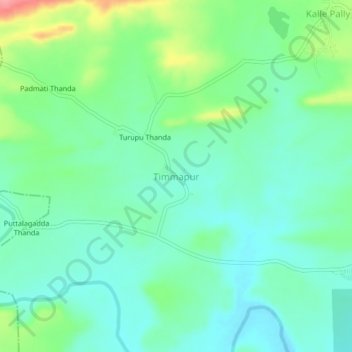
Name: Timmapur topographic map, elevation, terrain.
Location: Timmapur, Damaracherla mandal, Nalgonda, Telangana, India (16.70572 79.53078 16.74572 79.57078)
Average elevation: 335 ft
Minimum elevation: 246 ft
Maximum elevation: 564 ft
Thank you for supporting this site ❤️
Make a donation
Make a donation
Gear up for your next adventure:
As an Amazon Associate, this site earns from qualifying purchases at no extra cost to you.