Geolocate

Pieve topographic map

Click on the map to display elevation.

About this map

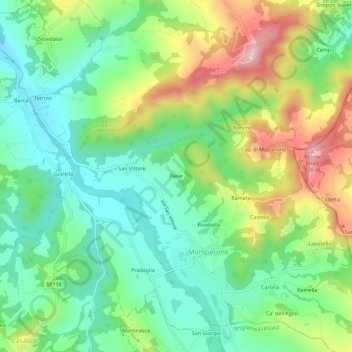
Name: Pieve topographic map, elevation, terrain.

Location: Pieve, Momperone, Alessandria, Piemonte, Italia (44.82706 9.01016 44.86706 9.05016)

Average elevation: 1,060 ft

Minimum elevation: 689 ft

Maximum elevation: 1,736 ft

Gear up for your next adventure:

🩳Quick‑Dry Hiking Shorts - Comfortable and quick‑dry shorts for summer hiking
🎒Hydration Pack - Hands‑free water reservoir for long hikes
🛡️Insect Repellent - Protection against bugs during outdoor activities
🪶Survival Guide Book - Expert advice for emergency preparedness
🗺️NatGeo Topo Maps - High-quality waterproof printed topographic maps of US Parks

As an Amazon Associate, this site earns from qualifying purchases at no extra cost to you.