Geolocate

Muir Beach topographic map

Click on the map to display elevation.

About this map

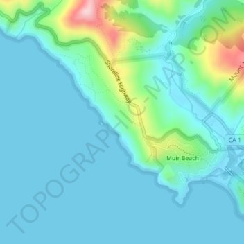
Name: Muir Beach topographic map, elevation, terrain.

Location: Muir Beach, Marin County, California, United States (37.85694 -122.59863 37.87529 -122.57432)

Average elevation: 131 ft

Minimum elevation: -7 ft

Maximum elevation: 787 ft

Marin County trails, hiking, mountain biking, running and outdoor activities

Gear up for your next adventure:

🪑Portable Camp Table - Compact table for campsite meals
🪑Ultralight Camp Chairs - Portable seating for resting after a long day of mapping
🔊Portable Camp Speaker - Music and alerts at camp
Backpacking Tents - Weight-optimized shelters for multi-day topographic surveys
GPS Sports Watch - GPS watch for running, hiking and training

As an Amazon Associate, this site earns from qualifying purchases at no extra cost to you.