
Thank you for supporting this site ❤️
Make a donation
Make a donation
Gear up for your next adventure:
As an Amazon Associate, this site earns from qualifying purchases at no extra cost to you.
Somanahalli topographic map
Click on the map to display elevation.
Thank you for supporting this site ❤️
Make a donation
Make a donation
Gear up for your next adventure:
As an Amazon Associate, this site earns from qualifying purchases at no extra cost to you.
About this map
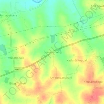
Name: Somanahalli topographic map, elevation, terrain.
Location: Somanahalli, Hunasuru taluk, Mysuru District, Karnataka, India (12.30068 76.32121 12.34068 76.36121)
Average elevation: 2,602 ft
Minimum elevation: 2,500 ft
Maximum elevation: 2,697 ft
Thank you for supporting this site ❤️
Make a donation
Make a donation
Gear up for your next adventure:
As an Amazon Associate, this site earns from qualifying purchases at no extra cost to you.