
Thank you for supporting this site ❤️
Make a donation
Make a donation
Gear up for your next adventure:
As an Amazon Associate, this site earns from qualifying purchases at no extra cost to you.
Hanwatkhed topographic map
Click on the map to display elevation.
Thank you for supporting this site ❤️
Make a donation
Make a donation
Gear up for your next adventure:
As an Amazon Associate, this site earns from qualifying purchases at no extra cost to you.
About this map
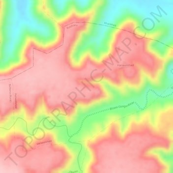
Name: Hanwatkhed topographic map, elevation, terrain.
Location: Hanwatkhed, Buldhana, Maharashtra, India (20.54670 76.20449 20.56710 76.23361)
Average elevation: 1,880 ft
Minimum elevation: 1,512 ft
Maximum elevation: 2,093 ft
Thank you for supporting this site ❤️
Make a donation
Make a donation
Gear up for your next adventure:
As an Amazon Associate, this site earns from qualifying purchases at no extra cost to you.