Geolocate

Normal topographic map

Click on the map to display elevation.

About this map

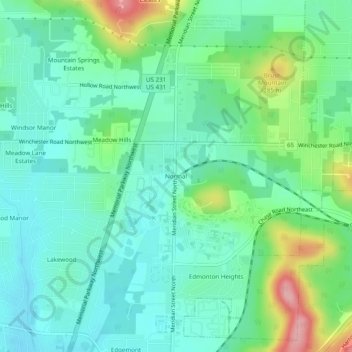
Name: Normal topographic map, elevation, terrain.

Location: Normal, Huntsville, Madison County, Alabama, 35762, United States (34.76898 -86.59194 34.80898 -86.55194)

Average elevation: 774 ft

Minimum elevation: 656 ft

Maximum elevation: 1,099 ft

Other topographic maps

Click on a map to view its topography, its elevation and its terrain.

Gear up for your next adventure:

🧭Map Reading Tools - Tools and kits for map navigation
⛑️Personal Locator Beacon - Safety beacon for emergencies
🔭Telescopic Hiking Pole - Adjustable pole for hiking stability
🎁Geography Themed Gifts - Unique gift ideas for map lovers and geography enthusiasts
📖Nature Tracking Books - Learn to track wildlife and terrain

As an Amazon Associate, this site earns from qualifying purchases at no extra cost to you.