
Thank you for supporting this site ❤️
Make a donation
Make a donation
Gear up for your next adventure:
As an Amazon Associate, this site earns from qualifying purchases at no extra cost to you.
凤冈县 topographic map
Click on the map to display elevation.
Thank you for supporting this site ❤️
Make a donation
Make a donation
Gear up for your next adventure:
As an Amazon Associate, this site earns from qualifying purchases at no extra cost to you.
About this map
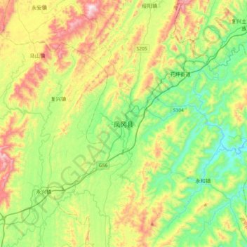
Name: 凤冈县 topographic map, elevation, terrain.
Location: 凤冈县, Guizhou, China (27.80408 107.54584 28.12408 107.86584)
Average elevation: 2,818 ft
Minimum elevation: 1,867 ft
Maximum elevation: 4,623 ft
Thank you for supporting this site ❤️
Make a donation
Make a donation
Gear up for your next adventure:
As an Amazon Associate, this site earns from qualifying purchases at no extra cost to you.