Geolocate

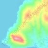
Tinurik topographic map

Click on the map to display elevation.

About this map

Name: Tinurik topographic map, elevation, terrain.

Location: Tinurik, Mabini, Tanauan, Batangas, Calabarzon, 4232, Philippines (14.04393 121.10197 14.08393 121.14197)

Average elevation: 469 ft

Minimum elevation: 66 ft

Maximum elevation: 663 ft

Other topographic maps

Click on a map to view its topography, its elevation and its terrain.

Darasa

Philippines > Batangas > Tanauan > Hidalgo

Average elevation: 568 ft

Darasa

Philippines > Batangas > Tanauan > Hidalgo

Average elevation: 568 ft

Barangay 4

Philippines > Batangas > Tanauan

Average elevation: 466 ft

Laurel

Philippines > Batangas > Tanauan

Average elevation: 502 ft

Banjo West

Philippines > Batangas > Tanauan > Banjo Laurel

Average elevation: 509 ft

Talaga

Philippines > Batangas > Tanauan > Talaga

Average elevation: 443 ft

Maria Paz

Philippines > Batangas > Tanauan

Average elevation: 210 ft

Barangay 3

Philippines > Batangas > Tanauan > Hidalgo

Average elevation: 518 ft

Barangay 5

Philippines > Batangas > Tanauan > Hidalgo

Average elevation: 505 ft

Suplang

Philippines > Batangas > Tanauan

Average elevation: 810 ft

Ambulong

Philippines > Batangas > Tanauan > Maugat

Average elevation: 92 ft

Ulango

Philippines > Batangas > Tanauan

Average elevation: 476 ft

Bañadero

Philippines > Batangas > Tanauan > Bañadero

Average elevation: 190 ft

Barangay 5

Philippines > Batangas > Tanauan > Hidalgo

Average elevation: 505 ft

Gear up for your next adventure:

🪑Portable Camp Table - Compact table for campsite meals
🛏️Cold Weather Sleeping Bag - Warm sleeping bag for cold conditions
📚USA Hiking Guide Books - Top trail guides and map books
🏥Hiking First Aid Kits - Comprehensive medical kits for remote trail injuries
⛑️Personal Locator Beacon - Safety beacon for emergencies

As an Amazon Associate, this site earns from qualifying purchases at no extra cost to you.