Geolocate

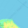
Kota Parit topographic map

Click on the map to display elevation.

About this map

Name: Kota Parit topographic map, elevation, terrain.

Location: Kota Parit, Simpang Kanan, Rokan Hilir, Riau, 28994, Indonesia (1.84852 100.37946 1.88852 100.41946)

Average elevation: 56 ft

Minimum elevation: 20 ft

Maximum elevation: 118 ft

Other topographic maps

Click on a map to view its topography, its elevation and its terrain.

Bagan Batu

Indonesia > Riau > Rokan Hilir

Average elevation: 157 ft

Sinaboi

Indonesia > Riau > Rokan Hilir

Average elevation: 3 ft

Tanah Putih

Indonesia > Riau > Rokan Hilir

Average elevation: 46 ft

Bangko

Indonesia > Riau > Rokan Hilir

Average elevation: 7 ft

Gear up for your next adventure:

🎒Waterproof Dry Bags - Keep your electronics and maps dry inside your pack
👟Trail Running Shoes - Lightweight shoes for trail runners
🔪Outdoor Multitools - Essential survival tools for gear repair and field use
🔋Rechargeable Batteries - Power up your outdoor devices
🔥Fast-Boil Camping Stoves - Efficient cooking systems for quick trail meals

As an Amazon Associate, this site earns from qualifying purchases at no extra cost to you.