Geolocate

Bad Bibra topographic map

Click on the map to display elevation.

About this map
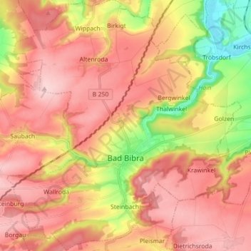
Name: Bad Bibra topographic map, elevation, terrain.

Location: Bad Bibra, An der Finne, Burgenlandkreis, Saxony-Anhalt, 06647, Germany (51.17434 11.51847 51.26148 11.64841)

Average elevation: 755 ft

Minimum elevation: 354 ft

Maximum elevation: 1,010 ft

Other topographic maps

Click on a map to view its topography, its elevation and its terrain.

Hainbergsee

Germany > Saxony-Anhalt > Burgenlandkreis > Nißma > Penkwitz

Average elevation: 643 ft

Gear up for your next adventure:

🥤Water Filter Bottle - All‑in‑one filter bottle for safe hydration
🖼️Topo Map Wall Art - Decorative topographic prints of famous peaks and regions
🧭Orienteering Set - Complete compass and map reading kit
🏥Hiking First Aid Kits - Comprehensive medical kits for remote trail injuries
🎒Outdoor Daypacks - Lightweight backpacks designed for carrying maps and essential gear

As an Amazon Associate, this site earns from qualifying purchases at no extra cost to you.