Geolocate

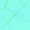
Betung topographic map

Click on the map to display elevation.

About this map

Name: Betung topographic map, elevation, terrain.

Location: Betung, Banyuasin, South Sumatra, 30758, Indonesia (-2.98320 104.16525 -2.68506 104.30727)

Average elevation: 52 ft

Minimum elevation: 3 ft

Maximum elevation: 197 ft

Other topographic maps

Click on a map to view its topography, its elevation and its terrain.

Sungai Gerong

Indonesia > South Sumatra > Banyuasin

Average elevation: 16 ft

Dao

Indonesia > South Sumatra > Banyuasin

Average elevation: 23 ft

Sebubus

Indonesia > South Sumatra > Banyuasin

Average elevation: 16 ft

Karang Baru

Indonesia > South Sumatra > Banyuasin

Average elevation: 10 ft

Purwosari

Indonesia > South Sumatra > Banyuasin

Average elevation: 10 ft

Muara Baru

Indonesia > South Sumatra > Banyuasin

Average elevation: 13 ft

Siju

Indonesia > South Sumatra > Banyuasin

Average elevation: 23 ft

Sungai Rengit

Indonesia > South Sumatra > Banyuasin

Average elevation: 59 ft

Air Solok Batu

Indonesia > South Sumatra > Banyuasin

Average elevation: 16 ft

Gear up for your next adventure:

🧥Men's Rain Shells - Premium waterproof and breathable jackets for mountain weather
🪶Survival Guide Book - Expert advice for emergency preparedness
💧Water Purification System - Clean water on the trail with reliable purifiers
🪶Wildlife Field Guides - Learn animal tracking and species ID
🌲Outdoor Survival Books - Best books on survival skills

As an Amazon Associate, this site earns from qualifying purchases at no extra cost to you.