Geolocate

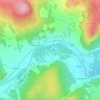
Bridge of Muick topographic map

Click on the map to display elevation.

About this map

Name: Bridge of Muick topographic map, elevation, terrain.

Location: Bridge of Muick, Ballater, Aberdeenshire, Scotland, AB35 5SN, United Kingdom (57.01975 -3.06717 57.05975 -3.02717)

Average elevation: 994 ft

Minimum elevation: 614 ft

Maximum elevation: 1,985 ft

Other topographic maps

Click on a map to view its topography, its elevation and its terrain.
Balmoral Castle

United Kingdom > Scotland > Aberdeenshire > Ballater

Average elevation: 1,122 ft

Balmoral Castle

United Kingdom > Scotland > Aberdeenshire > Ballater

Average elevation: 1,122 ft

Gear up for your next adventure:

🩹Survival Bandages - High‑quality bandages for emergencies
🪶Thermal Camp Blanket - Extra warmth for cold nights
🪶Camping Sleeping Pad - Comfortable sleeping pad for backpacking
🍳Camping Cook Set - Complete cookware for outdoor meals
🎒Gear Packing Cubes - Organize your backpack efficiently

As an Amazon Associate, this site earns from qualifying purchases at no extra cost to you.