Geolocate

Fair Grove topographic map

Click on the map to display elevation.

About this map

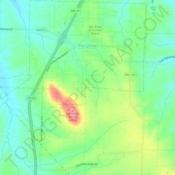
Name: Fair Grove topographic map, elevation, terrain.

Location: Fair Grove, Greene County, Missouri, 65648, United States (37.35177 -93.17345 37.39519 -93.13306)

Average elevation: 1,240 ft

Minimum elevation: 1,132 ft

Maximum elevation: 1,447 ft

Greene County trails, hiking, mountain biking, running and outdoor activities

Other topographic maps

Click on a map to view its topography, its elevation and its terrain.

James River

United States > Missouri > Greene County

Average elevation: 1,266 ft

Sacville

United States > Missouri > Greene County

Average elevation: 1,093 ft

Fellows Lake

United States > Missouri > Greene County

Average elevation: 1,339 ft

Republic

United States > Missouri > Greene County > Republic > Republic

Average elevation: 1,270 ft

Turners

United States > Missouri > Greene County

Average elevation: 1,286 ft

Ebenezer

United States > Missouri > Greene County

Average elevation: 1,247 ft

Mascot

United States > Missouri > Greene County

Average elevation: 1,234 ft

Wilsons Creek

United States > Missouri > Greene County > Springfield

Average elevation: 1,247 ft

Gear up for your next adventure:

Backpacking Tent - Lightweight and durable tent for multi‑day hikes
📖Nature Tracking Books - Learn to track wildlife and terrain
🛰️Satellite Messengers - Emergency SOS and two-way messaging for off-grid adventures
🪶Thermal Camp Blanket - Extra warmth for cold nights
🎁Geography Themed Gifts - Unique gift ideas for map lovers and geography enthusiasts

As an Amazon Associate, this site earns from qualifying purchases at no extra cost to you.