Geolocate

Greene County topographic maps

Click on a map to view its topography, its elevation and its terrain.

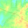
Galloway

United States > Missouri > Greene County > Springfield

Average elevation: 1,247 ft

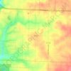
Hackney

United States > Missouri > Greene County

Average elevation: 1,119 ft

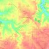
Brookline

United States > Missouri > Greene County > Republic

Average elevation: 1,266 ft

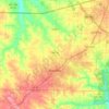
Haseltine

United States > Missouri > Greene County

Average elevation: 1,283 ft

Bois D'Arc

United States > Missouri > Greene County

Average elevation: 1,217 ft

Mentor

United States > Missouri > Greene County

Average elevation: 1,319 ft

Willard

United States > Missouri > Greene County

Average elevation: 1,191 ft

Republic

United States > Missouri > Greene County

Average elevation: 1,247 ft

Fair Grove

United States > Missouri > Greene County

Average elevation: 1,240 ft

Strafford

United States > Missouri > Greene County

According to the United States Census Bureau, the city has a total area of 2.63 square miles (6.81 km2), all land. USGS Department of the Interior Original Survey 1838 and USGS Topographical Maps show the town along the White River Road that became the Telegraph Road to Saint Louis.

Average elevation: 1,434 ft
Ebenezer

United States > Missouri > Greene County

Average elevation: 1,247 ft

Springfield

United States > Missouri > Greene County

Average elevation: 1,276 ft

About this place

 •

Gear up for your next adventure:

🏕️Tent Footprint - Protect your tent base from wear
👟Men's Trail Runners - Lightweight footwear for fast-paced exploration and light hiking
🔥Fast-Boil Camping Stoves - Efficient cooking systems for quick trail meals
⌚Solar GPS Watches - Advanced multisport watches with built-in topographic maps
🔦Powerful Headlamps - Ultra-bright hands-free lighting for night navigation

As an Amazon Associate, this site earns from qualifying purchases at no extra cost to you.