Geolocate

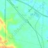
Neely topographic map

Click on the map to display elevation.

About this map

Name: Neely topographic map, elevation, terrain.

Location: Neely, Greene County, Mississippi, 39461, United States (31.14491 -88.77475 31.18491 -88.73475)

Average elevation: 187 ft

Minimum elevation: 98 ft

Maximum elevation: 259 ft

Greene County trails, hiking, mountain biking, running and outdoor activities

Other topographic maps

Click on a map to view its topography, its elevation and its terrain.
McLain

United States > Mississippi > Greene County

Average elevation: 85 ft

McLain

United States > Mississippi > Greene County

Average elevation: 85 ft

Gear up for your next adventure:

🧭Pro Hiking Compasses - High-accuracy liquid-filled compasses for topographic orientation
🥄Camping Utensil Set - Lightweight utensils for outdoor meals
🎁Geography Themed Gifts - Unique gift ideas for map lovers and geography enthusiasts
🛠️Backpacking Tool Kit - Essential toolkit for outdoor repairs
🧢Outdoor Hiking Hat - Sun protection hat for outdoor explorers

As an Amazon Associate, this site earns from qualifying purchases at no extra cost to you.