Geolocate

Gamero topographic map

Click on the map to display elevation.

About this map

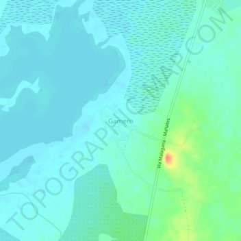
Name: Gamero topographic map, elevation, terrain.

Location: Gamero, Mahates, Dique, Bolívar, RAP Caribe, Colombia (10.18685 -75.23211 10.22685 -75.19211)

Average elevation: 33 ft

Minimum elevation: -3 ft

Maximum elevation: 171 ft

Gear up for your next adventure:

🌡️Handheld Weather Meters - Measure wind, temp, and pressure for safe mountain travel
🏔️Mountain Trail Maps - High‑detail maps for popular peaks
🏥Hiking First Aid Kits - Comprehensive medical kits for remote trail injuries
🔭Compact Binoculars - HD vision for scouting terrain and identifying distant landmarks
🎒Outdoor Daypacks - Lightweight backpacks designed for carrying maps and essential gear

As an Amazon Associate, this site earns from qualifying purchases at no extra cost to you.