Geolocate

Awbari topographic map

Click on the map to display elevation.

About this map
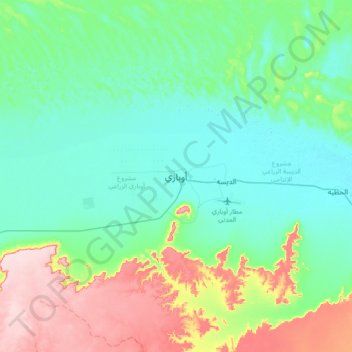
Name: Awbari topographic map, elevation, terrain.

Location: Awbari, Wadi al Hayaa, Libya (26.43094 12.60957 26.75094 12.92957)

Average elevation: 1,729 ft

Minimum elevation: 1,499 ft

Maximum elevation: 2,405 ft

Other topographic maps

Click on a map to view its topography, its elevation and its terrain.

Bint Bayyah

Libya > Wadi al Hayaa

Average elevation: 1,581 ft

Gear up for your next adventure:

🧣Merino Neck Gaiters - Multi-functional headwear for wind and sun protection
🩹Survival Bandages - High‑quality bandages for emergencies
🛶Inflatable Kayak - Portable kayak for rivers, lakes, and expeditions
📶Vehicle Signal Boosters - Improve reception in rural areas while driving to trailheads
🪶Camping Sleeping Pad - Comfortable sleeping pad for backpacking

As an Amazon Associate, this site earns from qualifying purchases at no extra cost to you.