Geolocate

Manaus topographic map

Click on the map to display elevation.

About this map

Name: Manaus topographic map, elevation, terrain.

Location: Manaus, Amazonas, North Region, 69000-000, Brazil (-3.18437 -60.80100 -1.91300 -59.16000)

Average elevation: 203 ft

Minimum elevation: 20 ft

Maximum elevation: 738 ft

Other topographic maps

Click on a map to view its topography, its elevation and its terrain.
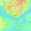
Manaus

Brazil > Amazonas > Manaus

Average elevation: 108 ft

Gear up for your next adventure:

🎒Gear Packing Cubes - Organize your backpack efficiently
🌐World Map Poster - Decorative world maps with topographic info
👓Polarized Sunglasses - Outdoor sunglasses for glare reduction
📡GPS Antenna Upgrade - Enhance GPS reception in remote terrain
🗺️Topographic Maps - Detailed topo maps for hiking, exploring and outdoor navigation

As an Amazon Associate, this site earns from qualifying purchases at no extra cost to you.