
Thank you for supporting this site ❤️
Make a donation
Make a donation
Gear up for your next adventure:
As an Amazon Associate, this site earns from qualifying purchases at no extra cost to you.
Sautens topographic map
Click on the map to display elevation.
Thank you for supporting this site ❤️
Make a donation
Make a donation
Gear up for your next adventure:
As an Amazon Associate, this site earns from qualifying purchases at no extra cost to you.
About this map
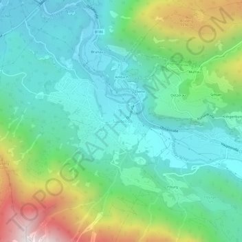
Name: Sautens topographic map, elevation, terrain.
Location: Sautens, Gemeinde Sautens, Bezirk Imst, Tyrol, 6432, Autriche (47.18839 10.84673 47.22839 10.88673)
Average elevation: 3,504 ft
Minimum elevation: 2,270 ft
Maximum elevation: 6,739 ft
Thank you for supporting this site ❤️
Make a donation
Make a donation
Gear up for your next adventure:
As an Amazon Associate, this site earns from qualifying purchases at no extra cost to you.