Geolocate

Frama topographic map

Click on the map to display elevation.

About this map
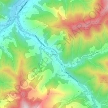
Name: Frama topographic map, elevation, terrain.

Location: Frama, Cabezón de Liébana, Cantabria, 39574, Spain (43.12715 -4.61266 43.16715 -4.57266)

Average elevation: 1,762 ft

Minimum elevation: 860 ft

Maximum elevation: 3,114 ft

Gear up for your next adventure:

🗺️NatGeo Topo Maps - High-quality waterproof printed topographic maps of US Parks
🎒Waterproof Dry Bags - Keep your electronics and maps dry inside your pack
🚪Portable Camp Chair - Foldable chair for comfort at camp
🧢Outdoor Hiking Hat - Sun protection hat for outdoor explorers
🎒Trekking Poles - Sturdy poles for balance and stability on rough terrain

As an Amazon Associate, this site earns from qualifying purchases at no extra cost to you.