Geolocate

Kingscourt topographic map

Click on the map to display elevation.

About this map

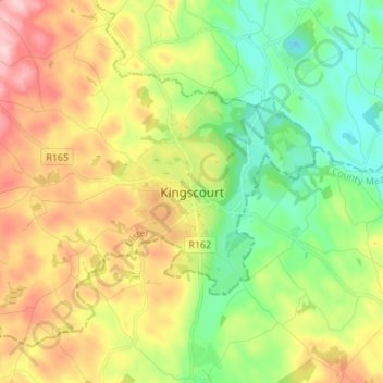
Name: Kingscourt topographic map, elevation, terrain.

Location: Kingscourt, County Cavan, Ireland (53.86805 -6.84544 53.94805 -6.76544)

Average elevation: 341 ft

Minimum elevation: 56 ft

Maximum elevation: 755 ft

Gear up for your next adventure:

🧭Pro Hiking Compasses - High-accuracy liquid-filled compasses for topographic orientation
🛡️Insect Repellent - Protection against bugs during outdoor activities
Backpacking Tents - Weight-optimized shelters for multi-day topographic surveys
🗺️Topographic Maps - Detailed topo maps for hiking, exploring and outdoor navigation
📷Action Cameras - Rugged cameras to document your journeys across rugged terrain

As an Amazon Associate, this site earns from qualifying purchases at no extra cost to you.