
Thank you for supporting this site ❤️
Make a donation
Make a donation
Gear up for your next adventure:
As an Amazon Associate, this site earns from qualifying purchases at no extra cost to you.
Shalman topographic map
Click on the map to display elevation.
Thank you for supporting this site ❤️
Make a donation
Make a donation
Gear up for your next adventure:
As an Amazon Associate, this site earns from qualifying purchases at no extra cost to you.
About this map
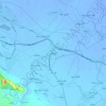
Name: Shalman topographic map, elevation, terrain.
Location: Shalman, دهستان دریاسر, بخش کومله, Langarud County, Iran (37.11592 50.17619 37.19592 50.25619)
Average elevation: -46 ft
Minimum elevation: -89 ft
Maximum elevation: 354 ft
Thank you for supporting this site ❤️
Make a donation
Make a donation
Gear up for your next adventure:
As an Amazon Associate, this site earns from qualifying purchases at no extra cost to you.