Geolocate

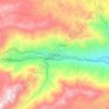
Bellavista topographic map

Click on the map to display elevation.

About this map

Name: Bellavista topographic map, elevation, terrain.

Location: Bellavista, Cisneros, Nordeste, Antioquia, RAP del Agua y la Montaña, Colombia (6.54467 -75.13674 6.56966 -75.10428)

Average elevation: 5,315 ft

Minimum elevation: 3,812 ft

Maximum elevation: 6,030 ft

Other topographic maps

Click on a map to view its topography, its elevation and its terrain.
Cisneros

Colombia > Antioquia > Cisneros

Cisneros is a town and municipality in the Antioquia Department, Colombia. Part of the subregion of Northeastern Antioquia, it lies at an altitude of 1,050 m (3,440 ft) above sea level.

Average elevation: 4,724 ft

Gear up for your next adventure:

🪶Paracord Bracelet - Survival bracelet with built‑in tools
🪑Portable Camp Table - Compact table for campsite meals
⛺Backpacking Tents - Weight-optimized shelters for multi-day topographic surveys
🔊Portable Camp Speaker - Music and alerts at camp
🧭Map Reading Tools - Tools and kits for map navigation

As an Amazon Associate, this site earns from qualifying purchases at no extra cost to you.