Geolocate

Clos Rozay topographic map

Click on the map to display elevation.

About this map

Name: Clos Rozay topographic map, elevation, terrain.

Location: Clos Rozay, Orléans, Loiret, Centre-Val de Loire, France métropolitaine, 45100, France (47.86894 1.87750 47.90894 1.91750)

Average elevation: 325 ft

Minimum elevation: 279 ft

Maximum elevation: 404 ft

Other topographic maps

Click on a map to view its topography, its elevation and its terrain.
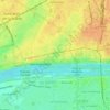
45000

France > Centre-Val de Loire > Loiret > Orléans > Cité Emile Zola

Average elevation: 367 ft

Gear up for your next adventure:

❄️Traction Cleats - Prevent slips on icy trails during winter hikes
🧺Microfiber Travel Towels - Compact and fast-drying towels for trail use
🥄Camping Utensil Set - Lightweight utensils for outdoor meals
📻Weather Alert Radios - Stay informed of storm risks while off-the-grid
🧭Map Reading Tools - Tools and kits for map navigation

As an Amazon Associate, this site earns from qualifying purchases at no extra cost to you.