
Thank you for supporting this site ❤️
Make a donation
Make a donation
Gear up for your next adventure:
As an Amazon Associate, this site earns from qualifying purchases at no extra cost to you.
Polvora topographic map
Click on the map to display elevation.
Thank you for supporting this site ❤️
Make a donation
Make a donation
Gear up for your next adventure:
As an Amazon Associate, this site earns from qualifying purchases at no extra cost to you.
About this map
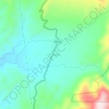
Name: Polvora topographic map, elevation, terrain.
Location: Polvora, Pólvora, Tocache, San Martín, Perú (-7.92760 -76.68820 -7.88760 -76.64820)
Average elevation: 1,995 ft
Minimum elevation: 1,545 ft
Maximum elevation: 3,264 ft
Thank you for supporting this site ❤️
Make a donation
Make a donation
Gear up for your next adventure:
As an Amazon Associate, this site earns from qualifying purchases at no extra cost to you.