Geolocate

Holly Bluff topographic map

Click on the map to display elevation.

About this map

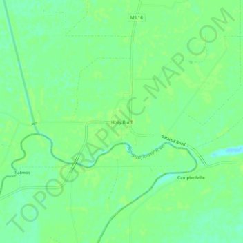
Name: Holly Bluff topographic map, elevation, terrain.

Location: Holly Bluff, Yazoo County, Mississippi, 39088, United States (32.80152 -90.72899 32.84152 -90.68899)

Average elevation: 98 ft

Minimum elevation: 75 ft

Maximum elevation: 108 ft

Yazoo County trails, hiking, mountain biking, running and outdoor activities

Other topographic maps

Click on a map to view its topography, its elevation and its terrain.

Yazoo City

United States > Mississippi > Yazoo County

Average elevation: 148 ft

Satartia

United States > Mississippi > Yazoo County

Average elevation: 125 ft

Satartia

United States > Mississippi > Yazoo County

Average elevation: 125 ft

Gear up for your next adventure:

📷Action Cameras - Rugged cameras to document your journeys across rugged terrain
🌲Outdoor Survival Books - Best books on survival skills
🏕️Tent Footprint - Protect your tent base from wear
🔋Solar Power Banks - Keep your GPS and phone charged in remote wilderness areas
🪶Fire Starter Kit - Reliable fire starter for survival and camping

As an Amazon Associate, this site earns from qualifying purchases at no extra cost to you.