Geolocate

Monticelo topographic map

Click on the map to display elevation.

About this map

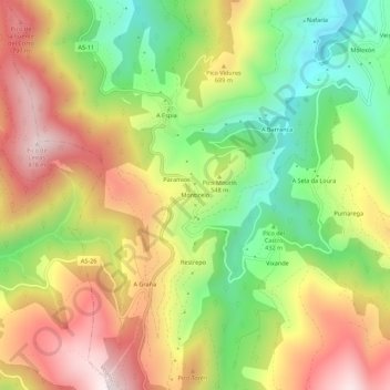
Name: Monticelo topographic map, elevation, terrain.

Location: Monticelo, Vegadeo, Asturias, 33776, Spain (43.36709 -7.03399 43.40709 -6.99399)

Average elevation: 1,745 ft

Minimum elevation: 659 ft

Maximum elevation: 2,887 ft

Gear up for your next adventure:

🎒Hydration Pack - Hands‑free water reservoir for long hikes
🛠️Outdoor Gear Repair Kit - Essential tools to fix gear on the trail
🧭Pro Hiking Compasses - High-accuracy liquid-filled compasses for topographic orientation
🌡️Portable Weather Meter - Track weather conditions on the trail
📚USA Hiking Guide Books - Top trail guides and map books

As an Amazon Associate, this site earns from qualifying purchases at no extra cost to you.