
Thank you for supporting this site ❤️
Make a donation
Make a donation
Gear up for your next adventure:
As an Amazon Associate, this site earns from qualifying purchases at no extra cost to you.
Aceitunilla topographic map
Click on the map to display elevation.
Thank you for supporting this site ❤️
Make a donation
Make a donation
Gear up for your next adventure:
As an Amazon Associate, this site earns from qualifying purchases at no extra cost to you.
About this map
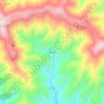
Name: Aceitunilla topographic map, elevation, terrain.
Location: Aceitunilla, Nuñomoral, Cáceres, Extremadura, 10626, España (40.41519 -6.26206 40.45519 -6.22206)
Average elevation: 2,680 ft
Minimum elevation: 1,621 ft
Maximum elevation: 3,763 ft
Thank you for supporting this site ❤️
Make a donation
Make a donation
Gear up for your next adventure:
As an Amazon Associate, this site earns from qualifying purchases at no extra cost to you.