
Thank you for supporting this site ❤️
Make a donation
Make a donation
Gear up for your next adventure:
As an Amazon Associate, this site earns from qualifying purchases at no extra cost to you.
Tecolapan topographic map
Click on the map to display elevation.
Thank you for supporting this site ❤️
Make a donation
Make a donation
Gear up for your next adventure:
As an Amazon Associate, this site earns from qualifying purchases at no extra cost to you.
About this map
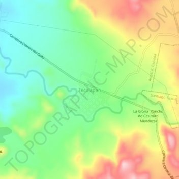
Name: Tecolapan topographic map, elevation, terrain.
Location: Tecolapan, Angel R. Cabada, Veracruz, México (18.55333 -95.35880 18.59333 -95.31880)
Average elevation: 607 ft
Minimum elevation: 266 ft
Maximum elevation: 1,115 ft
Thank you for supporting this site ❤️
Make a donation
Make a donation
Gear up for your next adventure:
As an Amazon Associate, this site earns from qualifying purchases at no extra cost to you.