
Thank you for supporting this site ❤️
Make a donation
Make a donation
Gear up for your next adventure:
As an Amazon Associate, this site earns from qualifying purchases at no extra cost to you.
Lego topographic map
Click on the map to display elevation.
Thank you for supporting this site ❤️
Make a donation
Make a donation
Gear up for your next adventure:
As an Amazon Associate, this site earns from qualifying purchases at no extra cost to you.
About this map
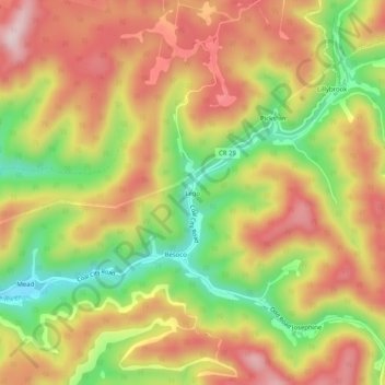
Name: Lego topographic map, elevation, terrain.
Location: Lego, Raleigh County, West Virginia, 25857, United States (37.61400 -81.25871 37.65400 -81.21871)
Average elevation: 2,297 ft
Minimum elevation: 1,716 ft
Maximum elevation: 2,785 ft
Thank you for supporting this site ❤️
Make a donation
Make a donation
Gear up for your next adventure:
As an Amazon Associate, this site earns from qualifying purchases at no extra cost to you.