
Thank you for supporting this site ❤️
Make a donation
Make a donation
Gear up for your next adventure:
As an Amazon Associate, this site earns from qualifying purchases at no extra cost to you.
Ruppertsgrün topographic map
Click on the map to display elevation.
Thank you for supporting this site ❤️
Make a donation
Make a donation
Gear up for your next adventure:
As an Amazon Associate, this site earns from qualifying purchases at no extra cost to you.
About this map
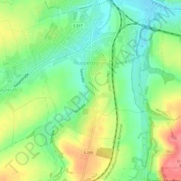
Name: Ruppertsgrün topographic map, elevation, terrain.
Location: Ruppertsgrün, Fraureuth, Zwickau, Sachsen, Deutschland (50.68760 12.35738 50.71461 12.38917)
Average elevation: 1,040 ft
Minimum elevation: 938 ft
Maximum elevation: 1,181 ft
Thank you for supporting this site ❤️
Make a donation
Make a donation
Gear up for your next adventure:
As an Amazon Associate, this site earns from qualifying purchases at no extra cost to you.