
Thank you for supporting this site ❤️
Make a donation
Make a donation
Gear up for your next adventure:
As an Amazon Associate, this site earns from qualifying purchases at no extra cost to you.
Gimiod topographic map
Click on the map to display elevation.
Thank you for supporting this site ❤️
Make a donation
Make a donation
Gear up for your next adventure:
As an Amazon Associate, this site earns from qualifying purchases at no extra cost to you.
About this map
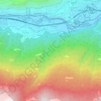
Name: Gimiod topographic map, elevation, terrain.
Location: Gimiod, Bovaye, Pontey, Aosta Valley, 11024, Italy (45.71175 7.57910 45.75175 7.61910)
Average elevation: 3,327 ft
Minimum elevation: 1,437 ft
Maximum elevation: 6,572 ft
Thank you for supporting this site ❤️
Make a donation
Make a donation
Gear up for your next adventure:
As an Amazon Associate, this site earns from qualifying purchases at no extra cost to you.