
Thank you for supporting this site ❤️
Make a donation
Make a donation
Gear up for your next adventure:
As an Amazon Associate, this site earns from qualifying purchases at no extra cost to you.
Ünalan topographic map
Click on the map to display elevation.
Thank you for supporting this site ❤️
Make a donation
Make a donation
Gear up for your next adventure:
As an Amazon Associate, this site earns from qualifying purchases at no extra cost to you.
About this map
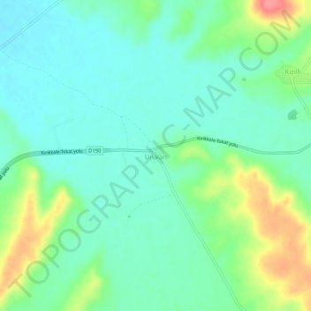
Name: Ünalan topographic map, elevation, terrain.
Location: Ünalan, Alaca, Çorum, Black Sea Region, 19600, Turkey (40.15422 34.88453 40.19422 34.92453)
Average elevation: 3,031 ft
Minimum elevation: 2,956 ft
Maximum elevation: 3,212 ft
Thank you for supporting this site ❤️
Make a donation
Make a donation
Gear up for your next adventure:
As an Amazon Associate, this site earns from qualifying purchases at no extra cost to you.