
Thank you for supporting this site ❤️
Make a donation
Make a donation
Gear up for your next adventure:
As an Amazon Associate, this site earns from qualifying purchases at no extra cost to you.
Navasomera topographic map
Click on the map to display elevation.
Thank you for supporting this site ❤️
Make a donation
Make a donation
Gear up for your next adventure:
As an Amazon Associate, this site earns from qualifying purchases at no extra cost to you.
About this map
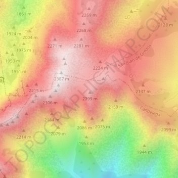
Name: Navasomera topographic map, elevation, terrain.
Location: Navasomera, Candeleda, Ávila, Castilla y León, España (40.23918 -5.27242 40.25918 -5.25242)
Average elevation: 6,670 ft
Minimum elevation: 4,823 ft
Maximum elevation: 7,812 ft
Thank you for supporting this site ❤️
Make a donation
Make a donation
Gear up for your next adventure:
As an Amazon Associate, this site earns from qualifying purchases at no extra cost to you.