
Thank you for supporting this site ❤️
Make a donation
Make a donation
Gear up for your next adventure:
As an Amazon Associate, this site earns from qualifying purchases at no extra cost to you.
Clinton topographic map
Click on the map to display elevation.
Thank you for supporting this site ❤️
Make a donation
Make a donation
Gear up for your next adventure:
As an Amazon Associate, this site earns from qualifying purchases at no extra cost to you.
About this map
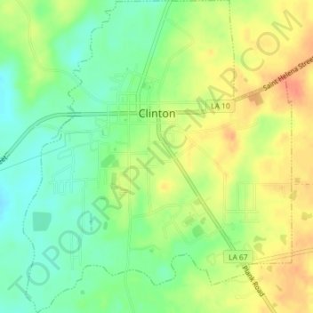
Name: Clinton topographic map, elevation, terrain.
Location: Clinton, East Feliciana Parish, Louisiana, United States (30.84589 -91.03114 30.87694 -91.00006)
Average elevation: 220 ft
Minimum elevation: 148 ft
Maximum elevation: 295 ft
East Feliciana Parish trails, hiking, mountain biking, running and outdoor activities
Thank you for supporting this site ❤️
Make a donation
Make a donation
Gear up for your next adventure:
As an Amazon Associate, this site earns from qualifying purchases at no extra cost to you.