Geolocate

Huashaoying topographic map

Click on the map to display elevation.

About this map

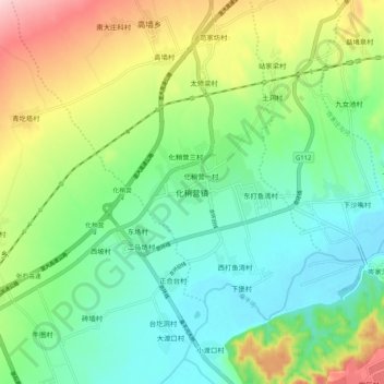
Name: Huashaoying topographic map, elevation, terrain.

Location: Huashaoying, Zhangjiakou, Hebei, China (40.21217 114.58043 40.29217 114.66043)

Average elevation: 2,877 ft

Minimum elevation: 2,638 ft

Maximum elevation: 3,369 ft

Other topographic maps

Click on a map to view its topography, its elevation and its terrain.

Chongli District

China > Hebei > Zhangjiakou

Average elevation: 4,751 ft

Dongwangshan

China > Hebei > Zhangjiakou

Average elevation: 3,406 ft

Qiaoxi District

China > Hebei > Zhangjiakou

Average elevation: 3,009 ft

Zhuolu County

China > Hebei > Zhangjiakou

Average elevation: 3,399 ft

Huai'an County

China > Hebei > Zhangjiakou

Average elevation: 3,619 ft

Yangyuan County

China > Hebei > Zhangjiakou

Average elevation: 3,816 ft

Gear up for your next adventure:

📚USA Hiking Guide Books - Top trail guides and map books
🧭Compass with Lanyard - Easy‑carry compass for navigation
🥤Water Filter Bottle - All‑in‑one filter bottle for safe hydration
🔥Fast-Boil Camping Stoves - Efficient cooking systems for quick trail meals
🛶Inflatable Kayak - Portable kayak for rivers, lakes, and expeditions

As an Amazon Associate, this site earns from qualifying purchases at no extra cost to you.