Geolocate

Stotfold topographic map

Click on the map to display elevation.

About this map

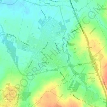
Name: Stotfold topographic map, elevation, terrain.

Location: Stotfold, Central Bedfordshire, England, United Kingdom (51.99794 -0.24543 52.03243 -0.20128)

Average elevation: 177 ft

Minimum elevation: 121 ft

Maximum elevation: 272 ft

Other topographic maps

Click on a map to view its topography, its elevation and its terrain.

Gear up for your next adventure:

🔭Telescopic Hiking Pole - Adjustable pole for hiking stability
🔥Camping Stove - Portable stove for camping and backcountry cooking
🎒Outdoor Daypacks - Lightweight backpacks designed for carrying maps and essential gear
⛑️Personal Locator Beacon - Safety beacon for emergencies
🔥Fast-Boil Camping Stoves - Efficient cooking systems for quick trail meals

As an Amazon Associate, this site earns from qualifying purchases at no extra cost to you.