
Thank you for supporting this site ❤️
Make a donation
Make a donation
Gear up for your next adventure:
As an Amazon Associate, this site earns from qualifying purchases at no extra cost to you.
Ffestiniog topographic map
Click on the map to display elevation.
Thank you for supporting this site ❤️
Make a donation
Make a donation
Gear up for your next adventure:
As an Amazon Associate, this site earns from qualifying purchases at no extra cost to you.
About this map
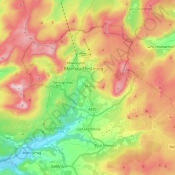
Name: Ffestiniog topographic map, elevation, terrain.
Location: Ffestiniog, Manod, Gwynedd, Wales, United Kingdom (52.94604 -4.00466 53.02256 -3.83262)
Average elevation: 1,175 ft
Minimum elevation: 0 ft
Maximum elevation: 2,467 ft
Thank you for supporting this site ❤️
Make a donation
Make a donation
Gear up for your next adventure:
As an Amazon Associate, this site earns from qualifying purchases at no extra cost to you.