Geolocate

Turunç topographic map

Click on the map to display elevation.

About this map

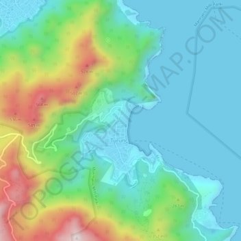
Name: Turunç topographic map, elevation, terrain.

Location: Turunç, Marmaris, Muğla, Aegean Region, 48740, Turkey (36.75288 28.22673 36.79288 28.26673)

Average elevation: 679 ft

Minimum elevation: -3 ft

Maximum elevation: 2,290 ft

Gear up for your next adventure:

🧭Compass with Lanyard - Easy‑carry compass for navigation
🎒Outdoor Daypacks - Lightweight backpacks designed for carrying maps and essential gear
🛰️Satellite Messengers - Emergency SOS and two-way messaging for off-grid adventures
🎒Trail Energy Bars - High‑calorie bars for hiking energy
🧯Emergency Survival Kit - All‑in‑one survival essentials for the backcountry

As an Amazon Associate, this site earns from qualifying purchases at no extra cost to you.