Geolocate

Parike topographic map

Click on the map to display elevation.

About this map

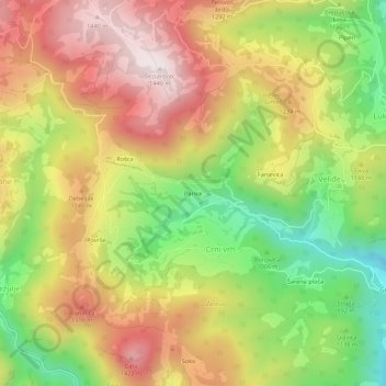
Name: Parike topographic map, elevation, terrain.

Location: Parike, Crni vrh, Berane Municipality, 84300, Montenegro (42.84283 19.80259 42.88283 19.84259)

Average elevation: 3,668 ft

Minimum elevation: 2,448 ft

Maximum elevation: 4,816 ft

Gear up for your next adventure:

🌡️Handheld Weather Meters - Measure wind, temp, and pressure for safe mountain travel
🔭Telescopic Hiking Pole - Adjustable pole for hiking stability
🚪Portable Camp Chair - Foldable chair for comfort at camp
🦟Ultrasonic Repellers - Create a bug-free zone at your camp or rest stop
🌡️Portable Weather Meter - Track weather conditions on the trail

As an Amazon Associate, this site earns from qualifying purchases at no extra cost to you.