Geolocate

Uson Island topographic map

Click on the map to display elevation.

About this map

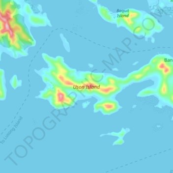
Name: Uson Island topographic map, elevation, terrain.

Location: Uson Island, Bancuan, Coron, Palawan, Mimaropa, Philippines (11.96574 120.13028 11.99222 120.19981)

Average elevation: 46 ft

Minimum elevation: -7 ft

Maximum elevation: 712 ft

Gear up for your next adventure:

🪑Portable Camp Table - Compact table for campsite meals
🥾Women's Hiking Boots - Top-rated trail boots with ankle support and superior grip
🩹Survival Bandages - High‑quality bandages for emergencies
📡Handheld GPS Device - Reliable handheld GPS for outdoor navigation
🦟Ultrasonic Repellers - Create a bug-free zone at your camp or rest stop

As an Amazon Associate, this site earns from qualifying purchases at no extra cost to you.