Geolocate

Periyar River topographic map

Click on the map to display elevation.

About this map

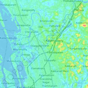
Name: Periyar River topographic map, elevation, terrain.

Location: Periyar River, Kochi, Ernakulam, Kerala, 683108, India (9.98335 76.25781 10.11550 76.35751)

Average elevation: 23 ft

Minimum elevation: -16 ft

Maximum elevation: 167 ft

Other topographic maps

Click on a map to view its topography, its elevation and its terrain.

Kochi

India > Kerala > Kochi

Average elevation: 13 ft

Gear up for your next adventure:

🔪Outdoor Multitools - Essential survival tools for gear repair and field use
🌎3D Topographic Globes - Raised relief globes for a tactile understanding of geography
📚USA Hiking Guide Books - Top trail guides and map books
🪓Survival Multi‑Tool - Versatile tool for camp and trail tasks
🪶Wildlife Field Guides - Learn animal tracking and species ID

As an Amazon Associate, this site earns from qualifying purchases at no extra cost to you.