Geolocate

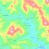
Mount Palali topographic map

Click on the map to display elevation.

About this map

Name: Mount Palali topographic map, elevation, terrain.

Location: Mount Palali, Nueva Vizcaya, Cagayan Valley, Philippines (16.42746 121.22242 16.42756 121.22252)

Average elevation: 4,177 ft

Minimum elevation: 2,822 ft

Maximum elevation: 5,436 ft

Other topographic maps

Click on a map to view its topography, its elevation and its terrain.
Kasibu River

Philippines > Nueva Vizcaya > Kasibu

Average elevation: 2,841 ft

Casecnan River

Philippines > Nueva Vizcaya > Pelaway

Average elevation: 3,159 ft

Kayapa

Philippines > Nueva Vizcaya

Average elevation: 4,127 ft

Gear up for your next adventure:

🪓Survival Multi‑Tool - Versatile tool for camp and trail tasks
🔌Solar Panel Charger - Charge gear sustainably outdoors
🔥Fast-Boil Camping Stoves - Efficient cooking systems for quick trail meals
🪶Trail Camera - Capture wildlife on your hikes
👓Polarized Sunglasses - Outdoor sunglasses for glare reduction

As an Amazon Associate, this site earns from qualifying purchases at no extra cost to you.