
Thank you for supporting this site ❤️
Make a donation
Make a donation
Gear up for your next adventure:
As an Amazon Associate, this site earns from qualifying purchases at no extra cost to you.
Kesavaneri topographic map
Click on the map to display elevation.
Thank you for supporting this site ❤️
Make a donation
Make a donation
Gear up for your next adventure:
As an Amazon Associate, this site earns from qualifying purchases at no extra cost to you.
About this map
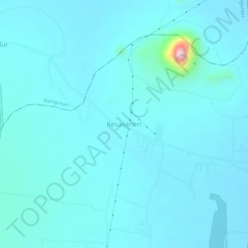
Name: Kesavaneri topographic map, elevation, terrain.
Location: Kesavaneri, Radhapuram, Tirunelveli, Tamil Nadu, 627117, India (8.38258 77.56435 8.42258 77.60435)
Average elevation: 427 ft
Minimum elevation: 335 ft
Maximum elevation: 1,506 ft
Thank you for supporting this site ❤️
Make a donation
Make a donation
Gear up for your next adventure:
As an Amazon Associate, this site earns from qualifying purchases at no extra cost to you.