Ibarra topographic map
Click on the map to display elevation.
Ibarra
Ibarra features a warm-summer mediterranean climate (Csb) under the Köppen climate classification. This is possible due to the town's high elevation (7,300 ft) in the Ecuadorian Andes providing cooler temperatures and a seasonal rain-shadow characteristic. The dry/warm season is technically local winter due to the town's location being south of the Intertropical Convergence Zone from June to September. However, since Ibarra is located just north of the equator, this season could be already be classified as summer. The highland climate is mild all year round.
About this map
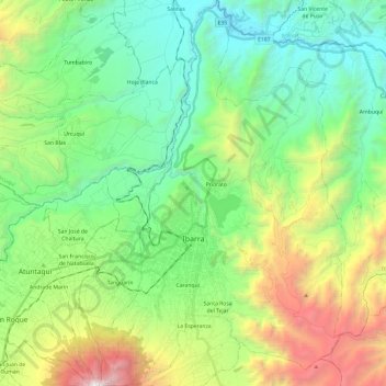
Name: Ibarra topographic map, elevation, terrain.
Location: Ibarra, Imbabura, Ecuador (0.26016 -78.17586 0.49989 -78.02502)
Average elevation: 7,867 ft
Minimum elevation: 4,879 ft
Maximum elevation: 14,875 ft
Other topographic maps
Click on a map to view its topography, its elevation and its terrain.