Geolocate

Maigo topographic map

Click on the map to display elevation.

About this map

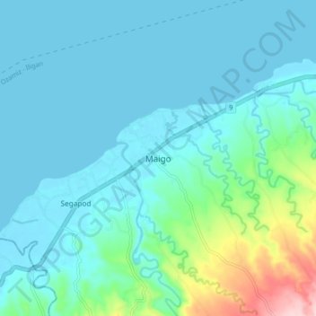
Name: Maigo topographic map, elevation, terrain.

Location: Maigo, Lanao del Norte, Northern Mindanao, Philippines (8.11862 123.92108 8.19862 124.00108)

Average elevation: 118 ft

Minimum elevation: -3 ft

Maximum elevation: 755 ft

Other topographic maps

Click on a map to view its topography, its elevation and its terrain.

Linamon

Philippines > Lanao del Norte

Average elevation: 138 ft

Kolambugan

Philippines > Lanao del Norte

Average elevation: 180 ft

Gear up for your next adventure:

🛡️Insect Repellent - Protection against bugs during outdoor activities
🚁Photography Drones - Capture stunning aerial views of landforms and topography
🔦LED Headlamp - Bright and durable LED headlamp for night navigation
🧤Tactile Hiking Gloves - Keep hands warm while operating GPS and smartphone screens
🧤Hiking Gloves - Protective gloves for rugged trails

As an Amazon Associate, this site earns from qualifying purchases at no extra cost to you.