
Thank you for supporting this site ❤️
Make a donation
Make a donation
Gear up for your next adventure:
As an Amazon Associate, this site earns from qualifying purchases at no extra cost to you.
Sharandhar topographic map
Click on the map to display elevation.
Thank you for supporting this site ❤️
Make a donation
Make a donation
Gear up for your next adventure:
As an Amazon Associate, this site earns from qualifying purchases at no extra cost to you.
About this map
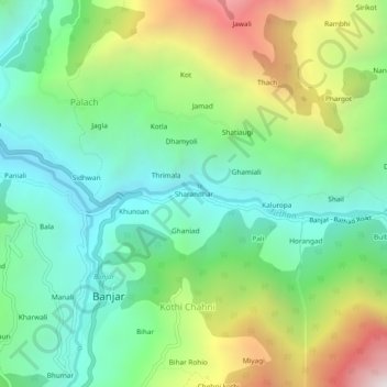
Name: Sharandhar topographic map, elevation, terrain.
Location: Sharandhar, Banjar, Kullu, Himachal Pradesh, 175123, India (31.62766 77.33547 31.66766 77.37547)
Average elevation: 5,840 ft
Minimum elevation: 4,108 ft
Maximum elevation: 9,314 ft
Thank you for supporting this site ❤️
Make a donation
Make a donation
Gear up for your next adventure:
As an Amazon Associate, this site earns from qualifying purchases at no extra cost to you.