Geolocate

Kerrville topographic map

Click on the map to display elevation.

About this map

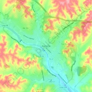
Name: Kerrville topographic map, elevation, terrain.

Location: Kerrville, Kerr County, Texas, 78029, United States (30.00847 -99.17995 30.08847 -99.09995)

Average elevation: 1,752 ft

Minimum elevation: 1,568 ft

Maximum elevation: 2,018 ft

Kerr County trails, hiking, mountain biking, running and outdoor activities

Gear up for your next adventure:

🦶Carbon Trekking Poles - Reduce knee impact on steep descents with ultra-light poles
🧭Map Reading Tools - Tools and kits for map navigation
📷Action Cameras - Rugged cameras to document your journeys across rugged terrain
🧺Microfiber Travel Towels - Compact and fast-drying towels for trail use
🌐World Map Poster - Decorative world maps with topographic info

As an Amazon Associate, this site earns from qualifying purchases at no extra cost to you.